

FIELD SOLUTIONS
CAM FIELD SOLUTIONS
The prize of increased efficiencies can be vast for pipelines and facilities construction management and inspection projects. CAM’s mission is to support our clients looking for more efficient solutions to design, build, and complete their projects in the field.

Construction Management, Surveying, and Right-of-Way are vital, necessary and integral aspects of every pipeline project. While sometimes challenging and difficult, CAM Field Solutions’ comprehensive and proficient approach in a constantly evolving and highly competitive market stands alone. As our respected, experienced, and talented team of professionals utilize the latest in technology and equipment, we guarantee precise accuracy and unparalleled client satisfaction.
CONSTRUCTION MANAGEMENT
The prize of increased efficiencies can be vast for pipelines and facilities construction management and inspection projects. CAM’s mission is to support our clients looking for more efficient solutions to design, build, and complete their projects in the field.
We provide services for:
-
Pipeline and Related Components
-
Compressor Stations
-
Pump Stations
-
Meter Stations
-
Interconnects
-
Gathering Stations
Field Services and Inspection:
-
Route and Alignment
-
Site and Construction
-
Plat Descriptions and Permits
-
Regulatory and Compliance
-
Inventory and As-Built
-
CAD Conversion
-
Construction and Material Inspection
Field and Supervisory Personnel:
-
Field Project Managers
-
Construction Managers
-
Chief Inspectors
-
Welding Inspectors
-
Safety Inspectors
-
Civil Inspectors
-
Coating Inspectors
-
Electrical Inspectors
-
Utility Inspectors
-
Vendor Inspectors
-
Environmental Inspectors

SURVEY
We utilize a technology centric approach that converts challenges into cost effective and efficient solutions.
TBPLS reg. No. 10194469
CAM provides Full Service Survey Engineering or task specific activities for your projects, inclusive of:
-
Route Selection and Surveys for HCA, Line Class and Obstructions
-
Reconnaissance Surveys for Environmental Assessment
-
Control Surveys (network and project)
-
Topographic Surveys
-
Right-of-Way and Easement Footprints
-
Lease Roads and Access Easements
-
Exhibits and Legal Descriptions Plats for Acquisition and Filing
-
Facility Design Surveys
-
Site Layout and Development
-
Alignment Sheets
-
Project Route Maps
Integration of Technology:
-
Collaboration and Visualization Platforms
-
Platform used for team collaboration and document management.
-
WebMap provides near real time visual project information (centerline, alternatives,
landowner, environmental, photos, & permits) -
GIS Database modeling and conversion to standard database models (PODS, APDM, Blue Sky Seed file, etc.)
-
Profile for Permit Application, (HDD’s, Railroads, Roads)
-
As-Built Surveys (pipe tally, weld mapping,
materials, in-ditch and post construction
data collection) -
GIS Data Collection and Verification Surveys
-
Boundary Surveys
-
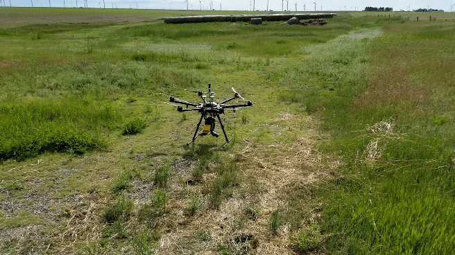
Lidar & Aerial Imagery collection via unmanned
aircraft (Drones) -
Construction Survey Support (Control, Centerline, Stake files)
3D LASER SCANNING
The 3D Laser Scanning Teams are involved in the full term of the project life cycle. From the definition of the project through the operation of the engineered system, the 3D Laser Scanning group is involved. This ensures that all of the pertinent data is captured and more importantly that all of that data is utilized, sometimes beyond the original intent. The Direct interface with the Engineering and design team helps in the understanding of the data as well as giving the 3D Laser Scanning Team a better idea of how to help the project meet its goals.

CAM provides Full Service 3D Laser Scanning or task specific activities for your projects, inclusive of:
-
Point Clouds to Assess Existing Conditions
(As-Builts) -
Equipment Fit Up Checks
-
Piping and Equipment Modeling
-
Pad, Pedestal, Structural, and Connector Modeling
-
E&IC Modeling
-
P&ID Tracing
-
Site Grading
-
Volume Calculations
-
Project Progressing
-
Construction Progressing
-
Safety Training
-
New Employee Training
-
Security and Evacuation Mapping
-
Ensure Project Datum and Control
-
Investigation and Post Accident Reporting
-
Lifting and Rigging Planning
-
Point to Point Measurements
-
Intuitive Free Point Cloud Viewers
-
Fabrication Inspections and QC
-
Deformation Mapping
-
Flatness and Slab Thickness Reporting
-
Legal Archiving
RIGHT OF WAY
CAM's Right of Way team has extensive skills and experience in right of way industries including negotiation, acquisition, leasing, permitting, abstracting, construction management, eminent domain coordination and procedure, due diligence, timber appraising, land appraisal procedure, pre-construction and post construction timber and crop damage valuation and settlements, environmental assessment, surveying, hydrostatic testing, and route and site design and selection.

CAM provides Full Service Right-of-Way support for all stages of your projects, inclusive of:
-
Project Management
-
Feasibility Studies
-
Route & Site Selection
-
Non-Environmental Permitting
-
Title Research & Management
-
Document Preparation & Management
-
Database Administration
-
Due Diligence
-
Survey Permission & Assistance
-
Non-Environmental Permitting
-
Acquisition of Easements, Leases & Fee Purchases
-
Construction Liaison & Damage Settlement
-
Eminent Domain Support
-
GIS & Mapping
-
Agent Training & Development
-
Public Relations & Stakeholder Outreach
-
Operations & Integrity Support